
Design
Cedar Creek Lake Shoreline: What to Know Before You Build
-
Bryce Arrington
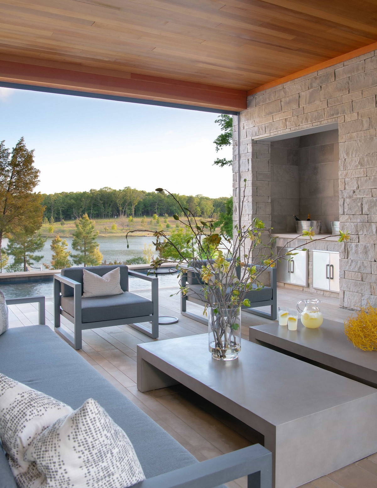
Nobody buys at Cedar Creek Lake for the lot. You buy it for the hour after dinner in late May, when the water goes flat and everyone ends up outside without anyone having suggested it. A house can be finished to the last fixture and that hour still will not happen on its own. It happens on the ground between the back door and the water, and on most lake properties that ground is the part nobody has solved.
It is also the part the Tarrant Regional Water District has an opinion about. Most owners discover that late, usually from a contractor, usually after a concept has been drawn. Discovered early, it is not an obstacle. It is the thing that tells you what the property actually wants to be.
Schedule a design consultation and we will walk the slope before anyone draws a line on it.
Why Does a Lake Lot Behave Differently From an Inland One?
An inland property is defined by its boundaries. A Cedar Creek property is defined by a contour. The District's interest runs to elevation 325.00 feet above mean sea level, and everything at or below that line requires a permit before it is built, filled or excavated. That line does not follow the fence. It cuts across the lawn.
On an ordinary lot, the terrace sets the elevations and the retaining follows. Here it runs the other way. The permitted wall is settled first, and the terrace, the lawn and the steps are resolved to meet it. Owners who have built inland find this genuinely disorienting, because the usual order of decisions is inverted.
The reframe worth holding onto is this: the regulated band is also the best part of the property. Because it cannot carry a building, it becomes terrace, lawn, steps and planting instead, which is precisely what you would want there anyway. The rule removes an option almost nobody should have taken.
Cedar Creek is a working reservoir, not a pond. It covers 34,000 acres across Henderson and Kaufman counties, roughly 50 miles southeast of Dallas, and has been full since 1965. The District holds Bridgeport, Eagle Mountain and Richland Chambers on the same basis. This is a long-established framework, not a local quirk, and it is navigable once somebody has done it before.
What Happens to the Design When the Lake Moves?
The lake does not hold still. Conservation level at Cedar Creek is 322.00 feet, the hundred-year flood level is 325.00, and the District holds a flood easement across the three feet between them. A design that only works at today's water line is a design that looks wrong for part of every year.
This is the question almost no one asks before building, and it is the one that separates a shoreline that ages well from one that does not. A terrace set to look perfect at full pool can read as stranded above a margin of exposed bank when the lake draws down in late summer. The planting that framed the view in June can be standing in water after a wet spring.
Designing for a moving edge means deciding, deliberately, what each level should look like. Where the lawn stops. Where the planting takes over so the drawdown margin reads as intentional ground rather than as something that got left behind. Where the steps land so they still make sense when there is more bank showing than there was in May.
It is a craft problem rather than a compliance one, and it is the part of a lake property that most rewards being thought through early.
The Shoreline Wall Is Architecture, Not Infrastructure

The District does not simply require a wall that stands up. It requires that a retaining wall improve the shoreline alignment, judged against the properties either side. That is a design standard written into a permit, and it is an unusually useful one to have on your side.
It means a patched, wandering shoreline inherited from a previous owner is not something you are obliged to preserve. The permitting framework expects the line to come out better than it went in, which is the argument a good designer would be making anyway. On the right property it turns a defensive repair into the single strongest horizontal line in the whole scheme.
The material palette is specific and worth knowing before anyone falls in love with a look. Concrete, soil cement, steel sheet piling at a minimum of 8 gauge, PVC sheet piling, pressure treated lumber and rip rap are all accepted. Creosote is not, which matters because reclaimed creosote timber still circulates as a rustic lakeside material and still turns up in inspiration images.
Because the alignment is fixed by the permit rather than by the terrace above it, the wall and everything it carries have to be drawn together. That is why we treat a lake shoreline as grading and retaining wall design from the first conversation rather than as a hardscape detail resolved later.
A Dock Belongs to the Yard
How much dock you are allowed is set by how much shoreline you own. Up to 150 linear feet of frontage, the allowance is eight square feet of structure per linear foot, capped at 1,200 square feet. Beyond that the formula tapers, adding four square feet per foot through 250 feet of frontage, two through 450, and one above that.
Read as arithmetic, that is a rule. Read as design, it is a fixed allowance, and spending it well is the whole question. A covered slip that crosses 1,200 square feet also pushes the required setback from five feet to twenty, which quietly costs thirty feet of usable frontage on a lot that may only have a hundred and fifty. A smaller, better-sited structure often buys back more shoreline than it gives up.
That trade is worth modeling before anyone commits, because it is not reversible and because the dock is the one element visible from every window on the water side. Treated as an afterthought bolted on once the yard is finished, it is the element most likely to look bolted on. A few things are simply not available regardless of frontage: no living quarters below spillway elevation, no enclosed structures, no toilet facilities, no three-story sun deck.
Where Does This Leave You If You Are Buying, Rebuilding or Building New?
The answer differs by where you are standing, but in all three cases the useful move is the same and it happens earlier than most people expect. Establish where elevation 325.00 crosses the property, and understand what is already permitted on it, before the design conversation gets specific.
If you are still choosing a property, the shoreline is a diligence item and not a detail. Two lots with identical frontage can carry very different possibilities depending on what has already been built below the line and whether it was permitted. A wall that is failing is not merely a repair; it is a permit, a design decision and a sequencing problem.
If you are rebuilding an older lake house, the ground almost certainly predates the house you are putting on it. Inherited walls, inherited grade and inherited planting rarely add up to a coherent line, and the rebuild is the only moment when fixing that costs a fraction of what it would cost later.
If you are building new, the sequencing advantage is enormous and routinely wasted. Shoreline work, site grading and the house footprint can be resolved as one plan rather than three, which is the difference between a terrace that meets the lake and a terrace that stops near it. This is land design and hardscape design working to the same drawing from the start.
There is a practical reason the plan comes first, too. The District asks for scale drawings with the permit application, alongside proof of ownership, and reviews them before an inspector visits. A property that already has a measured plan showing existing grade, the 325.00 contour and the proposed structures is a property that can apply without waiting. That drawing is the same document described in our explanation of what a landscape site plan is, and producing it after a concept has been agreed rather than before is how lake projects lose a season.
Our work at Long Cove on Cedar Creek Lake shows the approach resolved on a real shoreline, and the water-edge coordination at Gaines Bend in Palo Pinto follows the same sequence on a different reservoir.
Frequently Asked Questions About Cedar Creek Lake Shoreline Work
Do I need a permit to build a retaining wall on my Cedar Creek lot?
If any part of the wall sits at or below elevation 325.00 feet above mean sea level, yes. The Tarrant Regional Water District permits all construction, fill and excavation at or below that line. The wall also has to improve the shoreline alignment, which is a design standard rather than only a structural one, and it tends to work in a thoughtful owner's favor rather than against them.
How does the changing lake level affect a landscape design?
Cedar Creek sits at a conservation level of 322.00 feet, with a flood easement running up to 325.00. That means the visible edge of your property moves through the year. A design resolved only for today's water line can look stranded in a dry late summer, so the better approach decides in advance how the shoreline should read at several levels rather than one.
How big a dock am I allowed at Cedar Creek Lake?
Frontage sets the allowance. Up to 150 linear feet, you get eight square feet of structure per linear foot, capped at 1,200 square feet, with the formula tapering above that. Crossing 1,200 square feet raises the property line setback from five feet to twenty, so a larger structure can cost you more usable shoreline than it gains in covered space.
We are buying a lake property. What should we check about the shoreline?
Find out where elevation 325.00 crosses the lot and what already exists below it, including whether it was permitted. Two properties with the same frontage can offer very different possibilities depending on the condition and alignment of inherited walls. A failing shoreline is not simply a repair item; it carries a permit, a design decision and a construction sequence with it.
Start at the Water and Work Back

Most lake projects start at the house and work toward the water, and run out of options by the time they arrive. The properties that end up with that hour after dinner are the ones designed the other way around, beginning at the contour, resolving the shoreline, and letting the terrace, the lawn and the house meet a line that was settled first.
Knowing the constraints is not the achievement. Knowing them well enough to use them is.
Request a design consultation for shoreline and retaining work and we will start where the property does.
By Bryce Arrington, Studio Manager, Blount Designs
Published September 2026
Related


